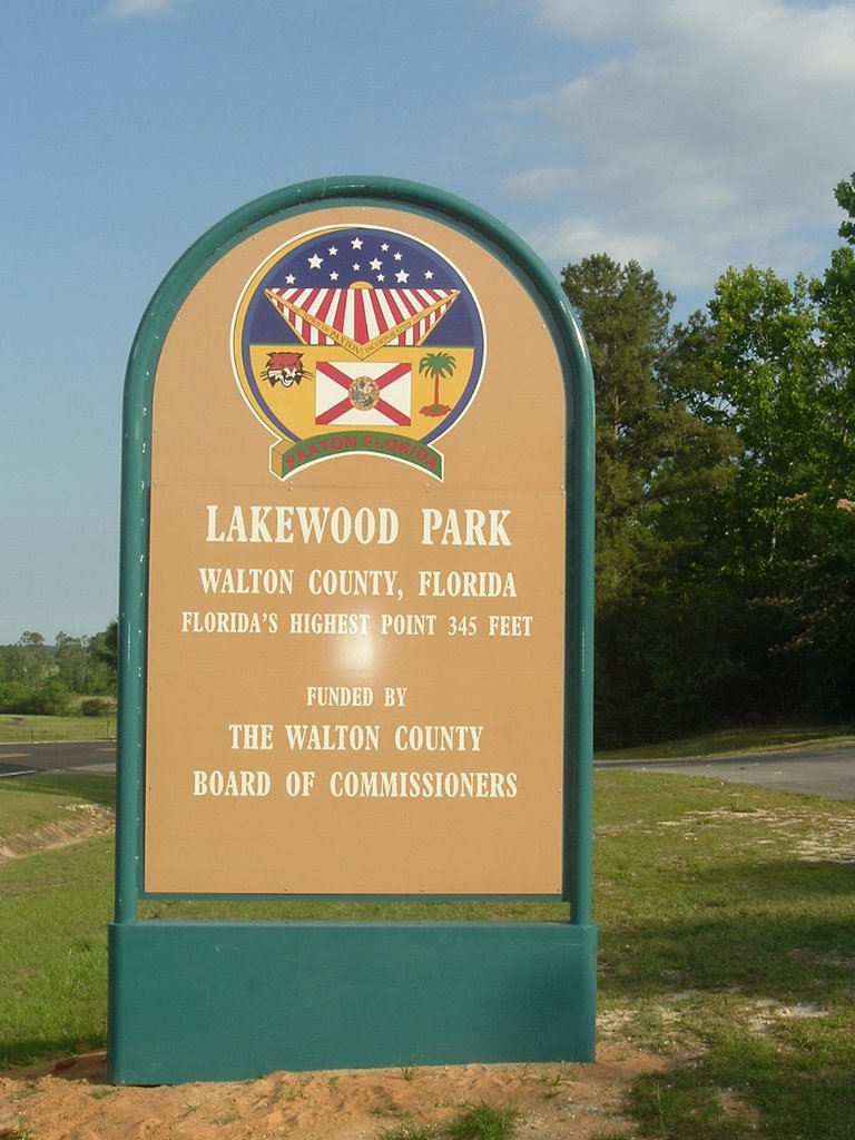
Highpoint #3
 2,407 feet ASL
Our weekend at Oak Mountain State Park with our good friends, Kim and Disco Dan Jordan was over and it was time to head back home to Orlando, FL. Instead of retracing our steps back through the highpoint of Florida, Krisha, Zoe, and I decided to go back through Cheaha Mountain in Alabama.
 On our way to Cheaha State Park, which contains the highpoint, the directions we had got confusing. In addition, the road signs in Alabama were very poor. Needless to say, we got lost trying to find the main road leading into the park. Several folks offered directions to get us back on the right track. I ended up going with the directions from a lady at a gas station we had stopped at. She interrupted me as I was looking at a map in her store and said she could give me better directions than the map. She was right. We were back on our way and quickly arrived to the entrace of the park.
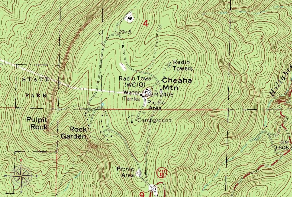
 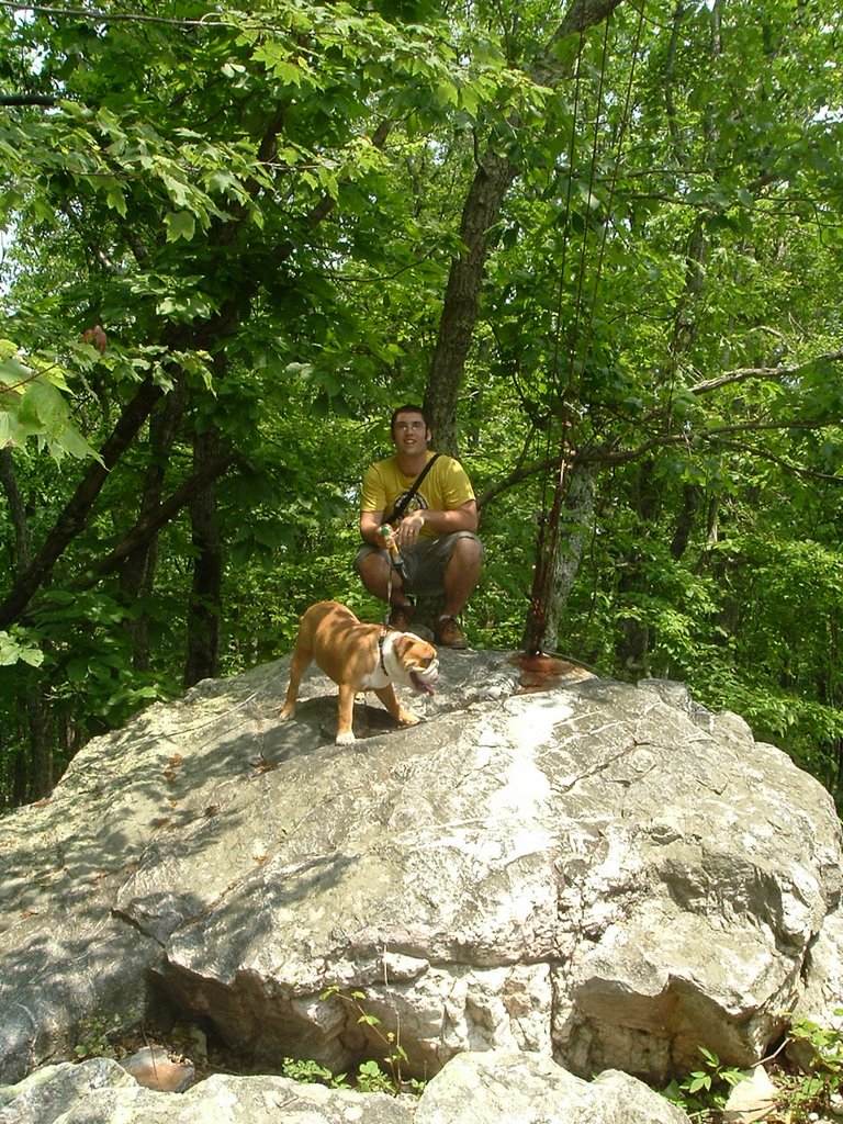 We paid the $1 entrance fee to bag this highpoint. I again got lost. The road in Cheaha State Park is circular in nature. So, I decided to do a few laps before spotting the sign pointing to the location of the highpoint. The summit was nice minus the radio towers and some parking areas that looked like they could use a repaving job. Zoe was glad to get out and stretch her legs and sniff a golden retriever at this highpoint. (I don't think the golden retriever was as excited as Zoe, judging by the retriever's growls.)
  There is a stone tower on the summit with several NGS survey markers. I climbed the tower on the summit, however, the views were less enjoyable. The skyline seemed to filled with a pretty thick smog. The actual highpoint appeared to be to the rear of the lookout tower. Zoe and I got a picture. After this summit, we were headed back home.
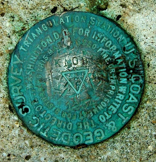
Final trip counts included 3 highpoints (FL, MS, AL) in 4 days, 0 miles hiked, 0 feet elevation gain, 3 NGS markers, 2 times getting lost, 1 broken down car
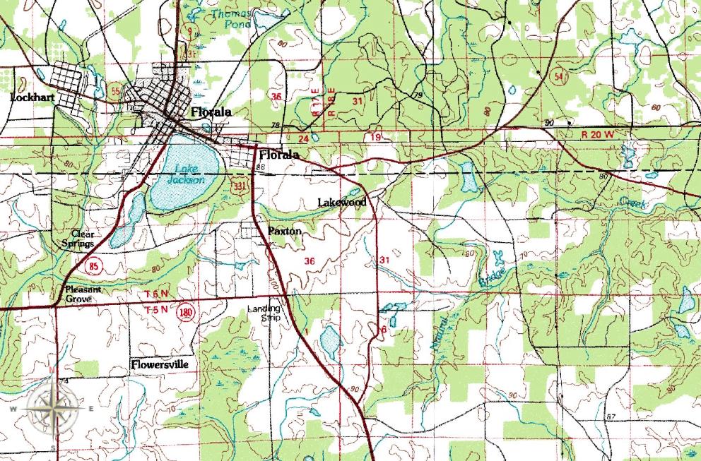
Topo Map