Highpoint #9
6288 feet ASL
As I mentioned in my last post, my cousin was getting married, so I was up in New Hampshire for the wedding. The day after the wedding was a free day to see the area. I had no plans to knock the highpoint of New Hampshire off the list. My aunt and uncle, however, had friends in the area. These friends enjoyed hiking the New Hampshire Mountains and suggested that we go see Mt. Washington. How I could I say no. So, several members of my family made the car ride to the base of Mount Washington. My aunt and uncle, their friends, my mom and dad, my unmarried sister, and my married sister and her husband and baby all made the trip.
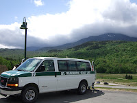
There are several ways to summit Mt. Washington, by foot, car, touring van, or cog railway. A hike was out of the question due to time constraints. I would have been up for driving the car, but several in our group thought the guided van would be safer. The cog railway would have been fun, but it was on the other side of the mountain and a quite a bit more expensive. Our tour guide was very professional and gave an insightful look into the history of Mt. Washington on the way up.

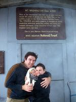
As the picture above indicates, the bottom of Mt. Washington was quite pleasant. Mid 70s, my toes were feeling quite comfortable in my Chacos. The top of the mountain was quite a different experience. Mt. Washington is known for having the highest recorded land wind speed at 231 mph, recorded in the 1930s. While the wind speeds were not that extreme, the winds at the top of my visit were around 50-60 mph with temperatures below freezing. My toes did not appreciate the visit. I think my sister's new child was not that appreciative either, but they did keep him in the summit house for most of the visit to the top.

There was about 20 more vertical feet to touch the actual summit. One would think this would not be difficult, but with the wind and cold, it was more difficult than planned. Several times, I almost slipped on the cold damp rocks. Nevertheless, a very extreme and fun mountain. I hope to get the opportunity to hike it some day.
 New Hampshire State Highpoint - Mt. Washington via the Auto Road at EveryTrail
Map created by EveryTrail:
GPS Trail Maps