 Highpoint #4
14,494 feet ASL
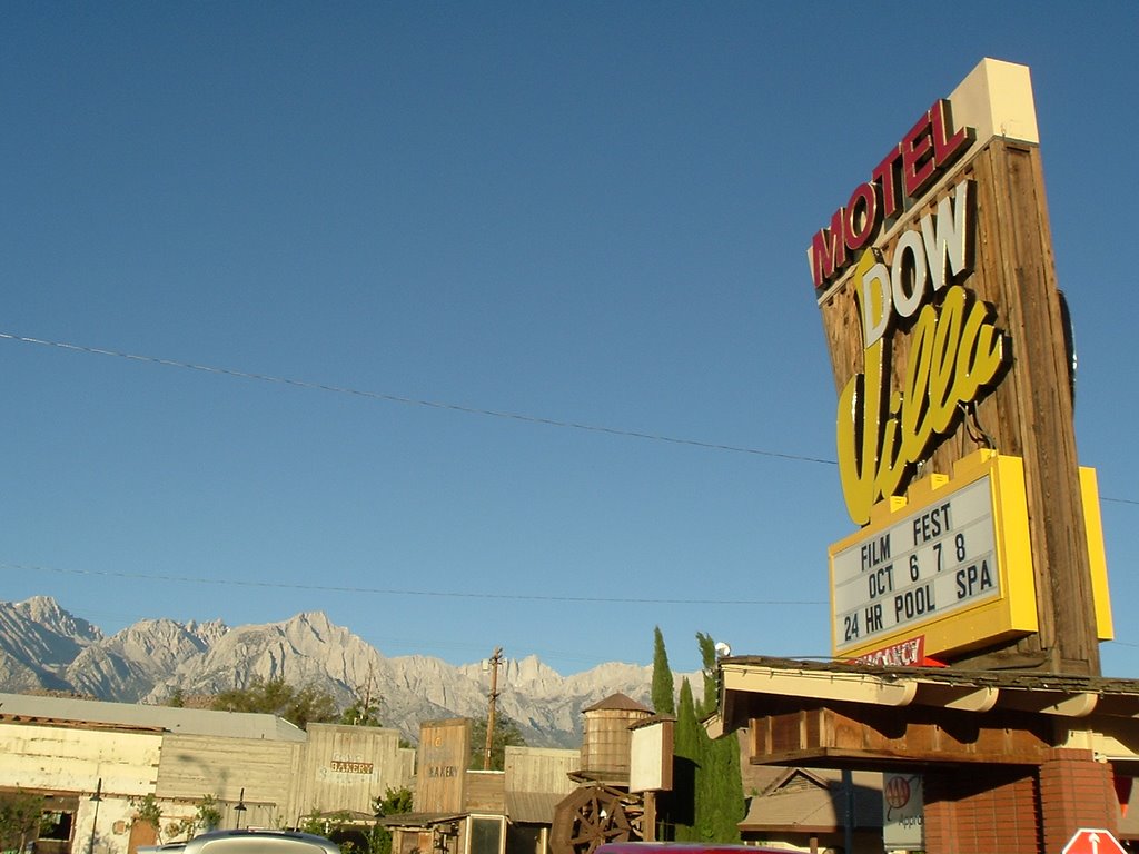
Friday, September 22 was a travel day from Orlando passing through Phoenix and finishing in Reno. My friend, Chris Winkler, who got me on the trip accompanied me. When we arrived in Reno we were given an upgrade on our car rental. We set off from the airport cruising in our aptly named PT Cruiser. The trip was pretty straight forward, Highway 395 South for 5 hours to Lone Pine, CA, the portal for Mt. Whitney. On the way there, we stopped for two Nevada geocaches right off of the road. We finally arrived in Lone Pine a few hours after dark had set in. We met most of the 11 member team at the Dow Villa motel. After a short meeting, it was time for some rest. I slept great.
 On Saturday, we were up and eating around 7:00am. I had some good pancakes and a lot of water at one of the local diners. We were on the trail by 9:30. The beginning section of the hike was pleasant, but Whitney looks unreachable. So small, yet so high. We took a rest at Lone Pine Lake at 11:30, where I almost ended my trip by slipping and tweaking my knee. Thankfully, I was okay to continue. By 4:30pm, we had completed the first 6.3 miles of the trip to Outpost Camp, 12,000 ft ASL.
 The hike to this point was manageable. The last hour was the hardest and I knew that my pace had slowed. The biggest factor for me was the elevation and lack of conditioning. While, I was out of shape, I certainly wasn't in shape, either. I had a mild headache and could tell the oxygen was thin. I set up my tent and started to prepare my MRE, however, I was only able to get the meal to a cool temperature. Nevertheless, I was hungry and the food tasted good. I also got some hot chocolate before jumping into my mummy bag. Anxiousness, no pillow, and less than my normal oxygen allowed me little sleep that night.
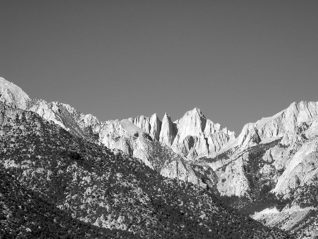
 On Sunday, I was up at 4:00am and ready to go. Unfortunately, I was the only one in my group ready. So, it was back to bed. At 6:15ish, I was back up and as I emerged from my tent was greeted by a glorious sight. The first rays of morning creeped onto the monolithic Mt. Whitney face, God was painting his canvas with hues of pink and orange. After taking in the view, it was time to give the ole wag bag a use. It wasn't as bad as I thought, but I prefer my home toilet.
 Only 5 of us were going to attempt the summit. Chris decided to go down with the two girls, who were giving him a ride back to the airport. Also, three others in our group did not have a good night and decided to head down for some more air. I was going to go up with Ryan, Jim, Yi, and Yao. Ryan and I headed out at 8:00 in front of the other three. The dreaded 99 switchbacks really were not that bad. Slow and steady, one by one, we knocked them. I propose the following song (sung to that famous classic 99 bottles of beer on the wall) for this section of the trail, "99 switchbacks on Mt. Whitney Trail, 99 switchbacks to go, take some steps, make a turn, 98 switchbacks on Mt. Whitney trail." We arrived at Trail Crest at 9:30. Ryan and I rested with about 15 others at this point. Eating was wretched. The clif bar I put down tasted like cardboard. Drinking wasn't that much better. After 15 minutes or so, we were up and ready to start hiking again as we saw the other three in our group arrive at Trail Crest.
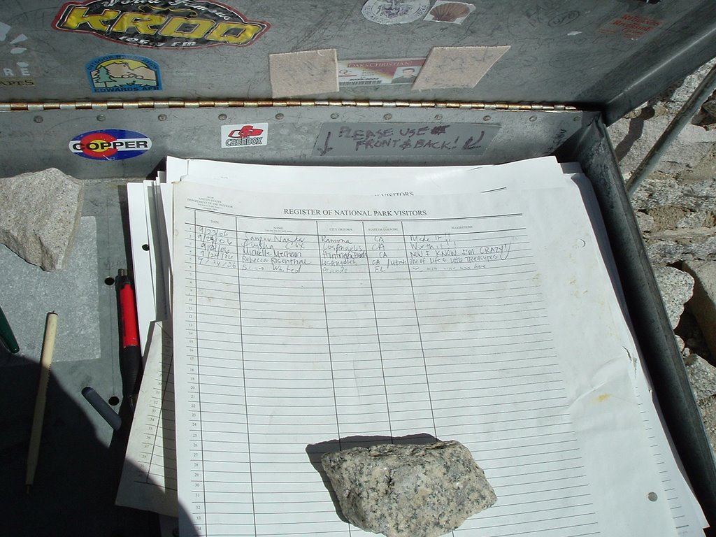 I expected Trail Crest to Mt. Whitney to be easier, but the trail seemed longer and I was more tired than I had imagined. I certainly got slower as Ryan and I got closer to the summit. I felt woozy, but thankfully did not have a headache. About 1/3 of a mile from the top, Ryan pushed on ahead. I kept going at a slower pace, but at 11:45, after many breaks, I made it to the summit of the 48 contiguous United States. To say that I was glad to be there would be an understatement. The top was crowded, but there was no wind and it actually felt warm. I took off my daypack and felt a little more energized. I walked around and looked for a geocache, but could not find it. I was able to grab a few photos of myself at the top, some NGS survey markers and the surrounding landscape. I also signed the summit register. A little while after I had arrived, the other three in our party joined us.
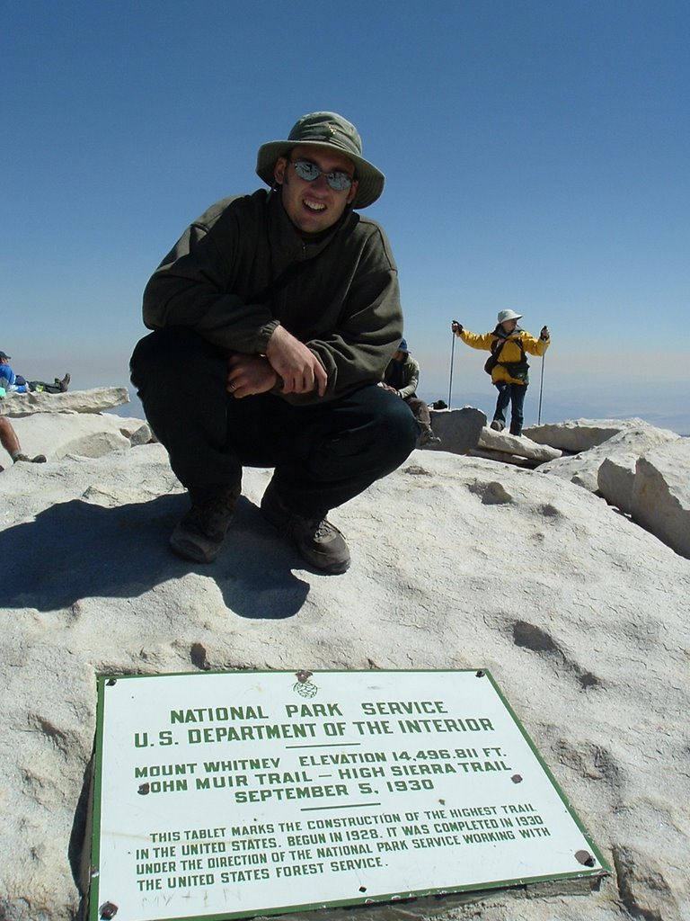 I left the summit around 12:15pm still feeling okay. However, by the time I made it down to trail camp, I was hit with a tremendous headache. I really felt horrible and did all I could to pack up. It was certainly not a packing job to brag about. Eventually, Ryan and I got back on the trail. Another hiker was gracious enough to give me some electrolytes and some goo gel, which by the way is very important if you do this hike. As I continued down I began to feel much better. As it started to get dark, the other members of our group caught up. Our group decided to pick up the pace realizing that if we went a little faster we could get to McDonald’s and their yummy Big Macs before it closed. The darkness did catch up with us before we got to the bottom, so we flipped on our LED headlamps. I was starting to wonder if I would ever pick up a cell phone reception and then my voicemail ring chimed in. I gave Krisha a call and experienced the joy of talking to her. At the bottom, I got my Big Mac combo and settled into a more pleasant night at the Dow Villa Motel.
Extra Trip Items
- If you would like to view some of my other Mt. Whitney pictures, you can do so here.
- You can read the hiking account from another member in our group here.
- You can download the Google Earth Track file (.kml) of my ascent hike here.
- You can download the GPS Trackpoint file (.gpx) of my ascent hike here.
- You can download a waypoint file (.gpx) of the Whitney Trail here.
- A larger set of waypoints for the Mt. Whitney Trail can be found at the following location: Travel by GPS.
My Route

Mt. Whitney Trail at EveryTrail
Elevation Profile

Topo Map

Mt. Whitney GPS Data (GaiaGPS)
No comments:
Post a Comment