I like maps. When I get a new map, I eagerly open it up and peruse its content. My wife thinks I'm a little crazy and she might be right. But, I love the idea that this map represents a nook on our vast planet earth. A nook that was fashioned by God waiting to be explored if one be so inclined. This highpointing adventure idea is one way in which I can combine my love for exploration and maps and my love for God. It is a chance for me to visit a part of His creation, to discover the beauty of it and in doing so to behold the greater beauty of the one who holds it together.
Whether I glimpse a setting sun, fill my lungs with crisp October air, or sit quietly on an empty mountaintop, I know it is the Lord who made it and governs it all. The creation is a reflection of His greatness and I am thankful that He has given me an opportunity to partake in it. What a gift!
Will I ever really have the time to get to the top of all fifty states? Only God knows. But even if I don't, there is always the new heavens and earth that awaits exploration. For now, however, onwards and upwards.
My wife and I headed to Seattle, WA to witness the marriage of a mutual college friend. At the reception I caught my first glimpse of Mt. Rainer...majestic. While Rainer wasn't planned for this trip, it did get me excited for Mt. Hood, which I would attempt in a few days.
Mt. Rainer
After the wedding, we headed down to Portland, OR, where I picked up my boots, crampons, ice axe and helmet. Then it was over to Rhododendron, OR, at the foot of Mt. Hood, where we had booked a fun cabin on AirBnB. Unfortunately, we arrived to a stationary front with lots of cloud and light drizzle at the foot of the mountain, but what would the summit be like? I met my guide, Aaron Hartz, with Timberline Mountain Guides. His first news wasn't good. Chair lift up the first half of the mountain was closed due to high winds and low visibility. Our original plan to go up and work on skills and then camp on mountain would have to change. We decided to work on our skills on a lower section of the mountain and then meet at the trailhead at midnight to attempt summit from the lodge.
Clouds, drizzle, and nastiness continued for the skills part and as I tried to go to sleep that night. I awoke to drive to trailhead and still clouds and rain, although perhaps a bit less. We started at Timberline Lodge with the mountain appearing to be socked in above Wilcox Hut. Climbed to the top of the ski lift in heavy freezing mist. But then, maybe, just maybe the clouds looked to be clearing. As we began again after a rest at the ski lift, I saw some stars and then the upper reaches of the mountain. Maybe I will get a chance. We put on our crampons and were headed up. Our next break was a doozy, wind picked up on a ridge with I'm estimating 30mph winds and 20 degree temps. Brutally cold, even with gear. Hard time getting back going, with cold muscles, though I might have to stop, but I was able to get into a rhythm and warmed back up.
We made it to the Devil's Kitchen, protected on three sides by the 1000 foot mountain walls. The sun started to rise, wind died down, we were above the clouds, with distant volcanoes peaks above the clouds. Fumaroles were active with sulfur smell.
We short roped up and made our ways to the Hogsback. We didn't traverse along the Hogsback, but instead opted for a muddy, sulfur section that lead to the Old Chute. Aaron went up the Chute and set a belay so I could manage the steepest section.
All that was left was a short ridge hike to the true summit. Unfortunately, some clouds pushed in to cloud the summit view, but I didn't care, I was glad to have made it up. 7 hours up, topping out at around 7:45 am (PCT). Texted my wife and good buddy and then we started the descent. We descended same route in 3.5 hours.
My family took a detour from the normal summer beach trip. Instead, we were off to mountains of Tennessee. We stayed in a cabin in Gatlinburg and got a taste of a truly touristy town, although I hear Pigeon Forge is even more touristy worse. We did border Smokey National Park, with numerous hiking trails and waterfalls to explore, including the summit of the great state of Tennessee, which made the trip worth it.
I warmed up the day with a hike of Mt. LeConte. My little sis joined me on this hike with over 2500 ft of elevation gain. We didn't have plans to stay in the summit lodge, but saw this neat little community and enjoyed the respite at the top.
Later in the day, the entire family packed into our cars and headed to the highpoint of Tennessee. The gang included my wife and two kids, my brother-in-law and sister and their kids, and my mom and dad.
We hoofed it up the short, but steep paved trail and to the summit monument, path thingy. I carried my kids for a bit of the way.
The Smokies were doing their thing, so the summit was socked in clouds, but still a good trip.
We were back in our cars and headed to a much needed all you can eat dinner at the Cataloochee Ranch.
A quick detour hike with my wife on our return trip home from the MTW conference in Greenville, SC. The drive to the hike gave my wife a bit of car sickness, but we arrived for a quick hoof up to the summit.
Benchmark
Sittin' on the Summit
Beautiful Fall Day for a Summit
Since EveryTrail is on the fritz, here is the GPS track date from Gaia GPS.
Earlier in the day I bagged the highpoint of CT, now I was headed toward Mount Greylock. I was cold, wet, and tired from the 5+ mile hike. I was glad this turned out to be a walk instead of a hike. If the weather was better, I would have enjoyed a hike, but as it was with the cold, clouds, wind, and pelting rain it was better to check this one off the list. Here is a video.
Back in the car, and a few hours later, back to summer vacation. Three more highpoints checked off the list.
This was the second day of bagging 3 planned state highpoints (NJ, CT, and MA) during a summer vacation 2013 trip to Providence, RI. A few day earlier on the way up to Providence, I bagged NJ with the family. Today, I was solo, leaving from Providence to hit up CT and MA and return back to Providence. There was heavy rain in the forecast and even severe a bit to the west and south of where I was headed. I was up early trying to edge out the rain at my destination. Only drizzle at the trailhead, although the actual trail was a lake from previous rains. I tried in vain to walk on the edge of the trail and stay dry, but soon I embraced the wet, there was no other choice
The highpoint of CT is interesting in that the highest point in the state is not the summit of a mountain, but rather on the side of the mountain, whose summit lies across the state line in MA. My route took me to the summit of Mount Frissell, but it was a few hundred yards down the mountain to the actual highpoint of CT. The log register at the summit of Mount Frissell explains the matter.
It was at the highpoint of CT that the rain caught up with me. From here on out, I would be wet and cold. But the highpoint (not summit) of CT was mine.
To complete the loop, there was another interesting marker, a tri-state point. This is a place where the borders of three states converge. In this case, CT, MA, and NY. CT must not have gotten the memo when the stone monument was being hewn because the CT designation was written in Sharpie, really CT.
I completed the loop and was back in my car heading to Mount Greylock, highest point in MA.
I've never had fond memories of NJ. My experiences with this state primarily consist of driving through the state on the NJ Turnpike, paying usury-like tolls, and for my viewing pleasure: industrial smokestack vistas. The moniker "armpit state" has rung true with me.
But hey, this was a great opportunity for me to rethink NJ, to give it a second chance looking down from its highest peak. The Whited clan first had to get there and also needed a reason. We were headed from Roanoke en route to Providence, RI for a week of summer vacation with some dear friends. We stopped for the night in Scranton, PA. We were paying homage to The Office, which had just weeks earlier had its series finale. My wife and I loved this show, it was our first "together as a couple show." We were faithful to watch and laugh through every episode of its 9 seasons. After our ode to The Office, we were a few hours drive to High Point State Park and only a short detour off our main path.
As I mentioned, New Jersey had a lot of work to do to change my perception of the state. Unfortunately, the weather was not on New Jersey's side. It was cold and rainy as we approached the park's entrance. I knew there was a fee to enter, but I was hoping on this treacherous day the fee might be waived because who comes to a park to swim in the lake or have a picnic, or hike on such a day as this. "$10 please for out of state residents." Seriously, I thought. My wife looks at me, her face speaking "Why are we here?" Well, because, I have a weird hobby and it would be more expensive if I had to come here on another day with the gas and all. I'm just thankful we didn't come a day earlier when the fee is $20 for non-residents on a weekend. Ridiculous. We drove past the lake, that no one was swimming in and where lifeguards are busy playing cards in the guardhouse making easy money. (I was once a lifeguard and we lived for days like these, no thunder or lightning, so we can't close, but really who is going to swim.) We drove to the parking lot, where a sign instructed us: handicapped vehicles can drive up the last quarter mile, but all others vehicles must park and occupants hoof it. I just paid $10, I'm going to use all of your road thank-you. Past the sign we drove. My wife snapped my picture from inside the car as the wind and rain pelted me in the face. My wife was not getting out of the car. I don't blame her. My kids were not going to either, but after telling them it would be an adventure, they bagged the highpoint with their dad.
So, I'm glad to have bagged this highpoint. And in a way, going this route, actually saved me from the NJ Turnpike and its tolls, which was nice. But do I still think NJ lives up to the aforementioned "armpit state." Why, yes, I do.
One of the easier highpoints. Hoosier Hill sits on private property,
but the landowners are gracious to allow public access. The most memorable moment of this highpoint was the drive
to it on Route 227. The road has plenty of hills and dips
to tickle your tummy. We also thought the trail around the highpoint
was epic.
Our friends from Richmond, Indiana accompanied us on this epic journey and officially knocked off their first highpoint.
I also discovered that Nessie from Loch Ness is a frequent visitor to Hoosier Hill. Check just to the west on the satellite photo below and see if you can spot her.
This highpoint was a family affair. The Whited family jumped into a cozy, fuel efficient car (Brian's description--cramped and trunkless is how Krisha remembers it) and headed for Richmond, Indiana to visit some good friends that left us in Roanoke for the greener hills--ahem--I mean golden, flat cornfields of the Midwest. This highpoint was an hour detour that Brian could not pass up.
We arrived in fading sunlight. The highpoint sits on a vocational school. It was open and we drove mere steps away from the highpoint of Ohio. There was a trail register, interesting signs, and benchmarks that Brian enjoyed. There was a field for the kiddos to stretch their legs. Krisha enjoyed the view.
It was a short visit and then we were back on the road to Richmond. Thanks, Ohio.
I grabbed this highpoint on the way back from my cousin's wedding in New Hampshire. There had previously been access issues with this highpoint, but no longer. A well-groomed short trail leads to the highpoint of Rhode Island. Very little elevation gain makes for an easy hike. Just make sure you visit between 8am and 4pm.
There are several benchmarks along the short trail as well that some might be interesting in finding. Trail signs point to the benchmarks making them highly visible.
As I mentioned in my last post, my cousin was getting married, so I was up in New Hampshire for the wedding. The day after the wedding was a free day to see the area. I had no plans to knock the highpoint of New Hampshire off the list. My aunt and uncle, however, had friends in the area. These friends enjoyed hiking the New Hampshire Mountains and suggested that we go see Mt. Washington. How I could I say no. So, several members of my family made the car ride to the base of Mount Washington. My aunt and uncle, their friends, my mom and dad, my unmarried sister, and my married sister and her husband and baby all made the trip.
There are several ways to summit Mt. Washington, by foot, car, touring van, or cog railway. A hike was out of the question due to time constraints. I would have been up for driving the car, but several in our group thought the guided van would be safer. The cog railway would have been fun, but it was on the other side of the mountain and a quite a bit more expensive. Our tour guide was very professional and gave an insightful look into the history of Mt. Washington on the way up.
As the picture above indicates, the bottom of Mt. Washington was quite pleasant. Mid 70s, my toes were feeling quite comfortable in my Chacos. The top of the mountain was quite a different experience. Mt. Washington is known for having the highest recorded land wind speed at 231 mph, recorded in the 1930s. While the wind speeds were not that extreme, the winds at the top of my visit were around 50-60 mph with temperatures below freezing. My toes did not appreciate the visit. I think my sister's new child was not that appreciative either, but they did keep him in the summit house for most of the visit to the top.
There was about 20 more vertical feet to touch the actual summit. One would think this would not be difficult, but with the wind and cold, it was more difficult than planned. Several times, I almost slipped on the cold damp rocks. Nevertheless, a very extreme and fun mountain. I hope to get the opportunity to hike it some day.
My eclectic cousin was getting married in New Hampshire, which meant a road trip up to the wedding with my family. I've gotten my dad and to a lesser degree my mom interested in highpointing, so it was easy to convince them to stop and bag a few along the way, especially since the Delaware and Rhode Island highpoints are relatively close off of I-95.
Ebright does not require any significant elevation gain. The summit is basically a residential neighborhood and field. My family and I took an obligatory picture at a sign locating the area. As we were at the sign, a local came out and greeted us. I don't remember the ladies name, but she has effectively adopted the highpoint as her own. She will provide you with a friendly smile and local history about the area and the highpoint. Friendly indeed. She also told us how the actual highpoint is disputed. I did not feel compelled to walk the entire area in a grid fashion, but I did walk around to some of the more interesting points.
There are two benchmarks that I was able to locate. The state line between Pennsylvania and Delaware is also nearby. There is also an 1892 survey boundary marker in the area.
This was a highpoint of opportunity. I was on Spring Break/Reading Week at RTS. I decided to take a few days and visit Fredericksburg to see my parents and play in a reunion ultimate frisbee tournament with the JMU Hellfish.
I flew into Washington Dulles and my newly married sister picked me up from the airport. I had about 4 hours to kill until my dad would pick me up to take me to Fredericksburg. I asked my sister to drop me off at the Metro station before she headed off to work.
I bought my $6.50 Metro Day Pass and was on my way. I first headed over to Arlington Cemetery. There I was able to see the changing of the guard at the Tomb of the Unknown Soldier, a new memorial for the victims of the 9/11 attack on the Pentagon, and my grandmother's grave.
After Arlington Cemetery, I jumped back on the Metro and a few station hops later, I exited the Red Line - Tenleytown Stop, a mere quarter mile from the highpoint of Washington, DC. The hike to the highpoint was second in difficulty only to Florida's highpoint. I think the hardest point was coming out of the Metro Station, which is one of the deepest I've been in.
The actual highpoint was disappointing. I had read that the highpoint was maintained by the National Park Service and some of the buildings on the property may be. But the property was occupied by the Washington DC water and sewer authority, hence the name Reno Reservoir. Unfortunately, the property is enclosed by fence and barbed wire with numerous no trespassing signs. There were a few older buildings that I wish I could have entered, but alas, that was not the case. So, I walked the perimeter of the fence and considered the highpoint complete.
GPS Data
You can download the Google Earth Track file (.kmz) of my hike around Reno Reservoir here.
You can download the GPS Track file (.gpx) of the hike here.
(Note: To download the file, left click on the link and follow the instructions. Right clicking and pressing save as didn't work for me.)
It was time to knock off the highpoint for what I consider to be my home state. My wife and I were in Roanoke visiting her family. Mt. Rogers was only three hours away, so I found a day to go and left at 6:30am. Unfortunately, I used Google directions to get there. (While I usually am aptly pleased with Google products, their map directions still could use some work.) Their directions took me past the main entrance of Grayson State Park and up a gravel road that eventually led to a four wheel drive road with no trespassing signs. I decided to turn around and go back to the entrance of Grayson State Park, which I knew would lead me to the trailhead.
I was pretty upset with myself that I didn't originally pull into the State Park, thereby losing the extra time, but I regress. Once inside the State Park, I paid the $2 parking fee and pushed on to the parking lot. I had one last hill to climb before the parking lot when I discovered that the road, which had turned from black to white, was more slippery than I had first thought. As I neared the top, my momentum seized coming to rest on a slick icy incline. Thankfully, a ranger came up behind me and guided me back down safely. But this set back would mean an even longer hike, about an extra 1/2 mile each way. I thought I would really be pushing the time I needed to get back now. Nevertheless, I decided to try and set off at a pretty good clip.
I started up the 1/2 mile of road and into the hike. Almost immediately after leaving the road, I came across some wild ponies that roam the Grayson meadows. They were not shy at all, allowing me to come up and touch them. My time bonding with the horses was short-lived, however, as time was of the essence. I pushed on and was truly blessed by the scenery of the hike. The open meadows and bald rock tops were very picturesque.
The elevation gain of the hike was moderate. The biggest challenge I faced was wet trail conditions. Melting snow had made trail soggy in many places. By the end of the hike, my feet and pants were wet and muddy. It was, however, an absolutely gorgeous day. The air was crisp, the temperature was perfect.
I laughed at this toilet I came across near the top. This toilet was closed, another one could be found a little ways a way. I just didn't realize the Forest Service could be so blunt. After my little chuckle, I pushed to cover the last little bit of hike. The final push brought me into the land of Narnia. I entered a spruce forest, which was blanketed with 2 inches of snow. I passed rocks laden with icicles and ice steps. It was a perfect prelude to the summit. The actual summit is nothing special, it is covered with trees and there is no vista. But besides this one minor detail, the hike as a whole is one of the best I have been on. I would highly recommend my state's highpoint and consider one of the prettiest I've seen yet.
I took a slightly different way on the way back. Unfortunately, I missed my turn. By the time I realized it, the most direct route back to my trail was through a densely packed azalea grove. There were some horse/deer tracks, so I decided to take the direct route. Thankfully, after 30 minutes of ducking and moving through the grove, I emerged onto the main train and was back on track.
Near the end of my hike, I thought about mounting one of the wild ponies. I was definitely weary from the quick pace I was keeping. But wisdom got the best of me and I finished on my own two legs. I jumped in the car and was back on my way home, another grand adventure completed.
GPS Data
You can download a set of waypoints of a Mt. Rogers hike here. (Note: This route is different that the one I took.)
You can download the Google Earth Track file (.kmz) of my Mt. Rogers hike here.
You can download the GPS Trackpoint file (.gpx) of the hike here.
(Note: To download the file, left click on the link and follow the instructions. Right clicking and pressing save as didn't work for me.)
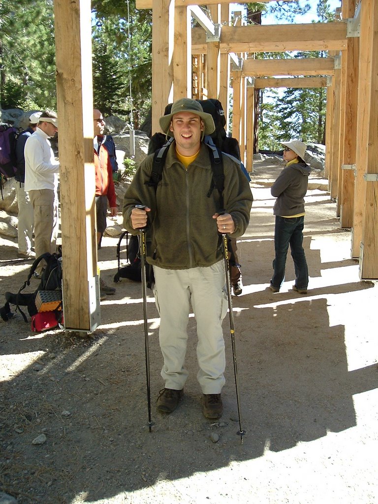 Getting Ready for Mt. Whitney


.jpg)
.jpg)


